| Map: Day 13 |
|---|
 |
|
|
| Day: 63.6 km | Trip: 950 km |
|
|
|
I
left the hostel at 8:15 AM after having Müsli for breakfast.
It was no problem to get to Picture Gorge which is very picturesque.
After passing through Picture Gorge the climbing begins. The road has no
shoulder of any kind till Antone Rd. which is 17 miles ahead.
The height profile of the Adventure Cycling map seems to be wrong.
The hill starts out steep for 17 miles and then levels off for the
last 9 miles to the top. After 30 km, i.e. 3 hours
of riding I got very hungry and stopped for some food. Luckily I bought
some girl scout cookies in Austin Junction. Some of these cookies and
an Apple and I could proceed. After 40 km I repeated this, I ate
more cookies and another apple. The last 9 miles to the top
are not very steep, in fact they are much easier to ride than the first
17 miles. But today a strong wind slowed me down again. I was
fighting more with the wind than with the hill.
Going
downhill I met a group of five bicyclists going up. Three of them were
riding recumbents, i.e. bikes where you sit on with the feet forward instead
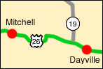
of downward. They started in Mitchell today (obviously very late) and are on
their way to Dayville.
I
reached Mitchell already at 2:25 PM, not bad. The first thing I did
was getting something to drink. As it was not very hot today, only
85 F and a cold breeze was blowing, I did not need much water,
only about 2 liters for the whole trip. The camping ground in
Mitchell is the public park. They have restrooms and a covered bench.
There was no cell phone coverage though.
|